When it comes to accurate and efficient mapping, choosing the right handheld GPS survey equipment is essential. These devices offer a blend of portability and precision, making them ideal for professionals in various fields. With options built for rugged terrain and advanced features, you’ll want to explore the top choices available. Let’s take a closer look at some of the best handheld GPS survey equipment that can elevate your mapping tasks.
ZL180 Handheld GPS for Surveying

The ZL180 Handheld GPS for Surveying is the perfect choice for professionals working in agriculture, landscaping, or land management who need reliable measurements in the field. Weighing just 180g, its rugged design and humanized grip make it easy to carry and use. With high precision accuracy from dual satellites, it minimizes area measurement errors to just 0.003 acres. You can measure areas and distances using various methods, ensuring versatility for different projects. The 2.4-inch FSTN display with backlight guarantees you’ll see results clearly, even in challenging conditions. This device is a game-changer for anyone serious about accurate surveying.
Best For: Professionals in agriculture, landscaping, and land management looking for reliable and precise measurements in the field.
Pros:
- High precision accuracy with minimal area measurement error (0.003 acres).
- Lightweight and rugged design enhances portability and ease of use.
- Versatile measurement capabilities with multiple methods for areas and distances.
Cons:
- Requires outdoor usage for satellite signals; ineffective indoors.
- Accuracy is best above specified area (0.16 acres) and distance (328 ft).
- Primarily intended for land surveying, not for navigation or waypoint saving.
Handheld GPS Survey Equipment for Rugged Terrain

For outdoor enthusiasts and professionals tackling rugged terrain, handheld GPS survey equipment offers high precision and adaptability. The BEVA device, weighing just 14.88 ounces, utilizes four satellite positioning systems, ensuring accuracy within ±0.002 acres. Its durable, waterproof design makes it perfect for harsh environments, while the 3.2-inch HD anti-glare display enhances visibility. Users appreciate its portability for hiking and large field measurements. However, it’s best for macro estimates rather than precise tasks like property boundaries. Regularly check for satellite signals and keep the battery charged to maintain peak performance in challenging landscapes.
Best For: Outdoor enthusiasts and professionals who need reliable measurements in rugged terrain.
Pros:
- High precision accuracy with four satellite positioning systems ensuring measurements within ±0.002 acres.
- Durable waterproof design suitable for harsh environments and outdoor use.
- Portable and lightweight at 14.88 ounces, making it easy to carry for hiking and fieldwork.
Cons:
- Inconsistent accuracy for smaller areas, particularly below 1/4 acre, limiting precision for detailed tasks.
- Lack of elevation data and unclear measurement orientation can lead to confusion during use.
- Reported issues with LED light and some users finding cell phone GPS more accurate for certain applications.
BEVA Mini Handheld GPS Survey Equipment

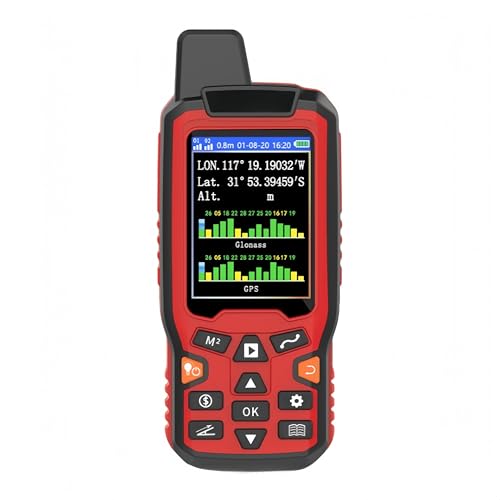
When precision matters, the BEVA Mini Handheld GPS Survey Equipment stands out as the ideal choice for surveyors and outdoor enthusiasts. With high accuracy supported by GPS and GLONASS, you get instant positioning with an area measurement error of just 1-2%. Its 2.4-inch LCD screen guarantees clear visuals, letting you set local time for your measurements. You can measure areas of any shape and length, while tracking figures for automatic price calculations. Plus, its durable, waterproof design fits comfortably in your hand or pocket, making it perfect for land segmentation, hillside measurements, and more.
Best For: Surveyors and outdoor enthusiasts who require high-precision land measurement in various terrains.
Pros:
- High accuracy: Supports GPS and GLONASS, providing an area measurement error of only 1-2%.
- Versatile measurement capabilities: Can measure areas of any shape and length, accommodating various applications.
- Durable and portable design: Waterproof, dust-proof, and fits comfortably in hand or pocket, making it suitable for outdoor use.
Cons:
- Limited screen size: The 2.4-inch LCD may be small for some users, especially for detailed readings.
- Potential learning curve: Users may need time to familiarize themselves with all features and settings for optimal use.
- Battery life concerns: Extended use in the field may require frequent recharging or spare batteries.
ZL190 Handheld GPS for Surveying

Engineers and surveyors tackling challenging terrains will find the ZL190 Handheld GPS an invaluable tool for their outdoor projects. This high-precision equipment supports four satellite systems—GPS, BEIDOU, GLONASS, and QZSS—ensuring minimal measurement errors, especially in areas over 0.16 acres and distances above 328 ft. With a 3.2-inch TFT backlit display, it’s easy to read, even in low light. Its IP65 waterproof and dust-proof design guarantees durability, while its portable size lets it fit comfortably in your hand or pocket. Remember to hold it horizontally for the best accuracy, and always read the user manual before use.
Best For: Engineers and surveyors working in challenging terrains who require high-precision measurements for outdoor projects.
Pros:
- Supports four high precision satellite systems for minimal measurement errors.
- Durable IP65 waterproof and dust-proof design suitable for outdoor use.
- Portable size with a backlit display for easy reading in various lighting conditions.
Cons:
- Requires horizontal positioning for accurate measurements.
- Limited to surveying purposes, not suitable for navigation.
- GPS altitude data may fluctuate due to satellite signal changes.
ZL190PLUS Rugged Handheld GPS for Surveying

The ZL190PLUS Rugged Handheld GPS is an ideal choice for surveyors seeking a reliable and durable tool in the field. Weighing just 7.8 ounces, this device features a sunlight-readable 3.2-inch color display. With support for six satellite systems and impressive accuracy, it measures areas down to 0.002 acres. Its IP65 rating guarantees durability, while the 4000 mAh battery provides up to 48 hours of use. An intuitive interface makes it easy to navigate, even for those without a surveying background. Plus, it includes essential accessories like a USB-C cable and power module, enhancing your surveying experience.
Best For: Surveyors and outdoor professionals seeking a lightweight, durable, and accurate GPS device for field measurements.
Pros:
- User-friendly interface suitable for individuals without a surveying background.
- Long-lasting battery life of up to 48 hours on a single charge.
- Supports multiple satellite systems for enhanced accuracy in various terrains.
Cons:
- Some users report difficulties with satellite lock in open areas.
- Limited to saving terrain coordinates without modification options.
- Relatively low Best Sellers Rank may indicate limited market presence.
EM90 GPS Land Meter, Handheld Land Surveying Equipment

For those who need reliable and precise measurements in challenging terrains, the EM90 GPS Land Meter stands out as an ideal choice. With a Pro GSP GNSS receiver, it delivers positioning accuracy within 1.5 meters, making it perfect for farmland, forests, and mountains. Its 2.4-inch color LCD allows for easy data viewing, while the device supports CSV file transfers. Weighing just 0.82 lbs and featuring a robust, waterproof design, it’s built for durability. Plus, with a 2500mAh battery, you can survey longer without interruptions. The EM90 is your go-to for effective land surveying in any environment.
Best For: The EM90 GPS Land Meter is best for land surveyors and professionals working in agriculture, forestry, and mining who require precise measurements in various terrains.
Pros:
- High positioning accuracy of ≤1.5m, suitable for detailed land assessments.
- Durable design that is waterproof, dustproof, and resistant to impacts, ensuring longevity in challenging environments.
- Lightweight and portable at just 0.82 lbs, making it easy to carry during extensive surveying tasks.
Cons:
- Limited data storage capacity with a maximum of 50 records, which may be insufficient for extensive projects.
- Measurement error of 0.01 mu (approx. 6.67m²) may not meet the needs of users requiring ultra-high precision.
- Working temperature range of -20 to +60°C may restrict usage in extreme weather conditions.
Generic Handheld GPS Land Surveying Equipment
If you’re looking for a reliable tool for land surveying, the Generic Handheld GPS Land Meter stands out with its high sensitivity GNSS receiver. Weighing just 8.8 ounces and featuring a large 2.8-inch color display, it’s compact yet powerful. You’ll appreciate its eight area measurement modes and two distance measurement modes for versatile surveying. Plus, you can easily calculate land prices and export your data. While it has a mixed rating of 3.3 stars, many users praise its ease of use and accuracy. With a 30-day return guarantee, it’s a solid choice for your surveying needs.
Best For: Professionals and hobbyists in land surveying who need a portable and versatile GPS tool.
Pros:
- High sensitivity GNSS receiver supporting multiple signal types for accurate readings.
- Multiple area and distance measurement modes enhance versatility for different surveying tasks.
- User-friendly design with a large color display for easy visibility of data.
Cons:
- Mixed user ratings indicate potential issues with interface and durability.
- Weighs slightly more than some competing handheld GPS devices, which may affect portability.
- Limited warranty may not cover all user concerns or product issues.
E1 RTK GNSS Survey Equipment with IMU Rover & Base

Engineers and surveyors seeking reliable, high-precision measurements will find the E1 RTK GNSS Survey Equipment with IMU Rover & Base to be an exceptional choice. With a powerful 6700mAh battery providing 20 hours of endurance, it features quick initialization in just 5 seconds. You’ll enjoy centimeter-level precision, even in urban areas, thanks to its robust signal tracking across multiple constellations. The device supports various connectivity options like Bluetooth and WiFi, enhancing your workflow efficiency. Plus, it’s compatible with other brand base stations, ensuring versatility for your surveying needs. This equipment truly elevates your mapping capabilities.
Best For: Engineers and surveyors requiring high-precision measurements in challenging environments.
Pros:
- Fast initialization in just 5 seconds, allowing for quick setup and use.
- Supports multiple connectivity options, enhancing workflow efficiency and data transfer.
- Compatible with other brand base stations, providing versatility for various surveying applications.
Cons:
- U.S. users must obtain an FCC radio license for commercial use of the UHF function, which may add complexity.
- High precision equipment may come at a higher cost compared to standard GNSS solutions.
- Limited to 20 hours of battery life, which may require recharging during extended fieldwork sessions.
ZL180 Handheld GPS Surveying Equipment
The ZL180 Handheld GPS Surveying Equipment stands out as an ideal choice for professionals in fields like agriculture, forestry, and land surveying who demand high precision and durability in their tools. It supports both GPS and GLONASS satellite systems, ensuring accurate area measurements with minimal error. With a robust, IPX-7 rated design, it’s built to withstand harsh conditions. The 2.4-inch LCD display provides clear, real-time data, while the device’s lightweight, palm-sized form makes it portable. Plus, its 2500mAh rechargeable battery offers up to 10 hours of operation, making it perfect for extended fieldwork.
Best For: Professionals in agriculture, forestry, and land surveying who require high precision and durability in their surveying tools.
Pros:
- High precision measurements with minimal error for accurate surveying.
- Durable, waterproof, and dustproof design suitable for harsh outdoor environments.
- Lightweight and portable with a long battery life, ideal for extended fieldwork.
Cons:
- May have a learning curve for users unfamiliar with GPS surveying technology.
- Limited storage capacity for area and distance records compared to some advanced models.
- The 2.4-inch LCD display might be small for users who prefer larger screens for data visibility.
Rugged Handheld Measuring Device for Land Area and Distance Measurement

For outdoor enthusiasts and professionals who need precise measurements in rugged environments, the Rugged Handheld Measuring Device is an indispensable tool. Weighing just 132g, it fits comfortably in your hand, featuring a durable casing to withstand tough conditions. With high-precision GNSS tracking, you’ll enjoy positioning accuracy of 1–3 meters, even in remote areas. The device’s quick cold start and efficient battery life guarantee you stay productive throughout the day. Plus, with 16GB of internal memory and a Micro-USB interface, managing and transferring your field data is a breeze. It’s perfect for land measurement and various outdoor applications.
Best For: Outdoor enthusiasts and professionals requiring precise land area and distance measurements in rugged environments.
Pros:
- High-precision GNSS tracking with positioning accuracy of 1–3 meters.
- Compact and lightweight design (132g) for easy portability.
- Quick battery performance with rapid cold start and efficient data management features.
Cons:
- Limited to a positioning accuracy range of 1–3 meters, which may not be sufficient for all applications.
- Screen size (2.4 inches) may be small for some users when viewing detailed data.
- The rugged casing may add some bulk compared to non-rugged alternatives.
Factors to Consider When Choosing Gps Survey Equipment Handheld
When you’re choosing handheld GPS survey equipment, you need to contemplate several key factors. Accuracy and precision levels, display size, and durability are essential for effective use in the field. Don’t forget about portability and battery life, as these can greatly impact your overall experience.
Accuracy and Precision Levels
Choosing handheld GPS survey equipment involves understanding accuracy and precision levels, as these factors directly impact your measurement outcomes. Accuracy can vary, with area measurement errors typically ranging from 0.002 to 0.003 acres, depending on the satellite systems your device supports. Devices that utilize multiple satellite systems like GPS, GLONASS, and BEIDOU generally offer higher accuracy. For the best results, make measurements in areas larger than 0.16 acres and distances beyond 328 feet to reduce error rates. Some devices can achieve positioning accuracy as precise as 1-2% in larger areas, while smaller areas may show more variability. Finally, verify you hold the device horizontally during measurements to maintain accuracy and avoid significant discrepancies in the data collected.
Display Size and Clarity
How can the display size and clarity of handheld GPS survey equipment impact your measurement experience? A display size of 2.4 inches is common, offering decent visibility in various lighting conditions. However, opting for a larger 3.2-inch screen enhances readability, especially in bright outdoor settings. Clarity is essential too; high-resolution displays, like 240 x 320 pixels, make it easy for you to read data without straining your eyes. Backlit screens are also beneficial, allowing you to see measurement data clearly in low-light conditions. Additionally, anti-glare features minimize reflections from sunlight, ensuring the information on your screen remains legible. Ultimately, these factors contribute greatly to a more efficient and accurate mapping experience.
Durability and Weather Resistance
While you’re traversing challenging terrains, the durability and weather resistance of handheld GPS survey equipment are vital for guaranteeing reliable performance. Look for devices with an IP65 rating or higher, as this confirms they’re dust-proof and waterproof, ready for harsh conditions. A rugged design made from industrial-grade materials like ABS or TPU enhances durability, helping your equipment withstand impacts during fieldwork. Features like non-slip grips and anti-impact casings are essential to reduce damage from drops. Additionally, consider battery life specifications; a robust device should last up to 10 hours or more, allowing for all-day surveying without needing frequent recharges. By prioritizing these factors, you’ll guarantee your equipment can handle the demands of outdoor surveying.
Portability and Weight Considerations
After confirming your handheld GPS survey equipment can withstand tough conditions, it’s time to contemplate portability and weight. The weight of these devices usually ranges from about 132g (4.7oz) to 180g (6.3oz), so you’ll want to choose a model that balances durability and ease of handling. Compact designs are essential, allowing the device to fit comfortably in your hand or pocket during long outdoor sessions without causing fatigue. Lightweight models enhance your experience, reducing strain while maintaining high precision. Look for rugged constructions with ergonomic designs or rubberized cases, which not only improve grip but also help you navigate challenging terrains effortlessly. Prioritizing portability guarantees you can work efficiently in various environments.
Battery Life and Performance
When selecting handheld GPS survey equipment, battery life and performance are essential factors that can greatly impact your efficiency in the field. Some devices can last up to 48 hours on a single charge, while others may only provide around 10 hours. Look for models with rechargeable lithium batteries, as they offer quick charging and reduce downtime. Cold start times are also vital; some devices can be ready in less than 28 seconds, enabling swift deployment. Keep in mind that battery capacity affects operational range and power consumption, especially when using multiple measurement modes. Finally, consider battery management features that track usage and alert you to low levels, ensuring uninterrupted surveying sessions.
Measurement Capabilities and Modes
Understanding the measurement capabilities and modes of handheld GPS survey equipment is essential for achieving accurate results in your surveying tasks. High precision models can minimize area measurement errors to as low as 0.002 acres and distance errors to around 6 feet. Many devices support various measurement modes, allowing you to calculate areas across different terrains, whether flat fields or slopes. For peak accuracy, choose devices that recommend measurements for areas larger than 0.16 acres. Advanced methods like automatic tracking and multi-point distance measurement provide versatility, accommodating diverse surveying needs. Additionally, devices with multi-satellite system support, such as GPS, GLONASS, and Beidou, enhance positioning accuracy, especially in challenging environments. Choose wisely to guarantee efficient mapping.